Chamber Spotlight: Trails and Outdoor Routes

Trails and Outdoor Routes in the Charlottesville, VA Area
Shared by Chris Ridder, Destination Development Manager.
Charlottesville Albemarle Convention & Visitors Bureau wants to help visitors identify the best Trails and Outdoor Routes for outdoor recreation that fits their needs in Charlottesville and Albemarle County.
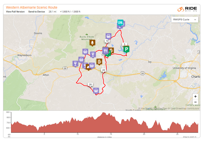
Partnering with Ride with GPS allows CACVB to highlight specific routes and provide information on the distance, elevation change, restrooms, places to park, and points of interest along the way. It has also allowed us to showcase all the great activities and recreation spots in one dedicated area of our website. Each activity page has an area dedicated to local stores and guides that can help you gear up for your adventure.
The highlighted routes are designed for beginner and intermediate users, allowing them to approach options within their skill level, and not feel intimidated or surprised by strenuous terrain. We have also used these pages to illustrate the importance of recreating responsibly, being prepared, and respecting the land.
With future development of this page, we hope to be able to tell the unique history of how certain trails or routes came to be, as well as those who made it possible, giving the visitor more to experience than just a line on a map.
Visit the Trails & Outdoor Routes page to find routes for hiking, biking, boating and more!
Explore country roads at the base of the Blue Ridge on the 28-mile Western Albemarle Scenic Tour route.
Get the Ride with GPS app to download any of these outdoor routes.

